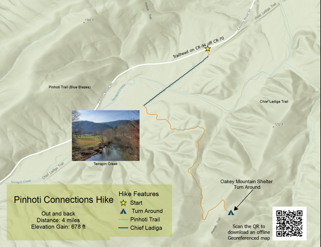
Begin at the Pinhoti Trail /Chief Ladiga Trailhead on CR-94 off Vigo Road (CR-70) east of Piedmont. This hike connects three outdoor destinations that Piedmont is famous for: the Pinhoti Trail, the Chief Ladiga Trail, and Terrapin Creek. The distance is 4 miles with an elevation gain of about 700 feet. The hike takes approximately 3 hours.
iPhone Download Instructions
- Download the Avenza Maps app onto your phone.
- Download the pdf from the website to your phone.
- Open Avenza and approve all permissions it asks. It definitely needs to access your location.
- The main landing screen has a green plus in the upper right corner. Push it.
- Push download or import a map.
- Push “from storage location” (5th option down)
- Navigate to where the pdf downloaded. Click to select.
- Press “open” in upper right corner.
- Once the map loads, and you are ready to go!
Android Download Instructions
- Download the Avenza Maps app onto your phone.
- Download the pdf from the website to your phone.
- Open Avenza and approve all permissions it asks. It definitely needs to access your location.
- The main landing screen has a orange plus in the lower left corner. Push it.
- Push download or import a map.
- Push “cloud storage or device” (4th option down)
- Navigate to where the pdf downloaded. Click to select.
- Once the map loads, and you are ready to go!